AERIAL FILM & PHOTOGRAMMETRY
CAPTURE COMPOSE LTD
2D. 3D. 360°
AERIAL 3D DIGITAL TWINS
& INTERACTIVE VIRTUAL TOURS
AERIAL FILM & PHOTOGRAMMETRY
CAPTURE COMPOSE
2D. 3D. 360°
3D DIGITAL TWINS
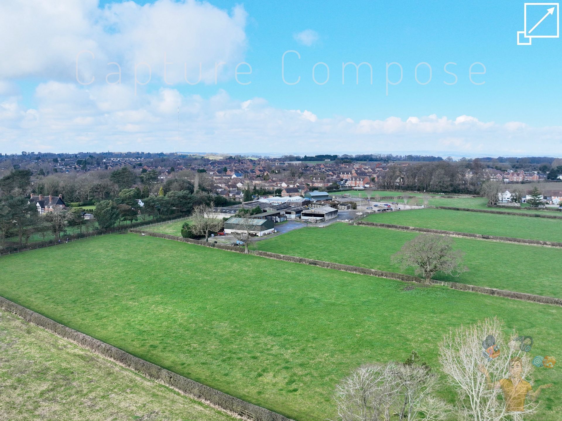
DRONE AERIAL
3D CAPTURE
INSPECTION, REFERENCE & ENGAGEMENT
ENTERPRISE-GRADE AERIAL UTILITY
DRONE3DETAIL DIGITAL TWINS
Advance operations for infrastructure governance through Precision Aerial Asset Intelligence.
Strengthen risk mitigation, regulatory compliance & condition lifecycle documentation with Structure & Terrain Digital Twins.
Deliver survey-grade measurements with High
Accuracy RTK Positioning.
TOURISM & PUBLIC ENGAGEMENT REEL
Showcase locations with Interactive virtual tours & cinematic film for compelling regional publicity material.
READY TO PUBLISH ONLINE ON TREND & ON POINT
Core Technical Deliverables:
- LOD 300+ spatial data acquisition
- Georeferenced point clouds
- Structural health monitoring
- Envelope condition inspection
- Controlled risk geometry capture
- Precision survey AEC outputs
- Immersive 3D model interaction
- Regional aerial marketing content
- Turnkey online platform hosting
- Commercially licensed operations
- Accredited professional workflows
❝ Drone operations offer efficient solutions to the commercial market, mitigating disruption while achieving detail with automation for
repeat results ❞
Residential | Commercial
Heritage | Tourism
Restoration | Conservation
DRONE AERIAL 3D CAPTURE
REDEFINING SATELLITE IMAGERY
INSPECTION,
REFERENCE &
ENGAGEMENT

ENTERPRISE-GRADE AERIAL UTILITY
BY CAPTURE COMPOSE LTD
GEOREFERENCED AERIAL DIGITAL TWIN
Drone3Detail by Capture Compose Ltd
Core Technical Deliverables:
Advance operations for infrastructure governance through precision
Aerial Asset Intelligence.
Strengthen risk mitigation, regulatory compliance & condition lifecycle documentation with audit-ready
Structure & Terrain Digital Twins.
Deliver survey-grade measurements with High Accuracy RTK Positioning.
Showcase locations with Interactive virtual tours & cinematic film for compelling Regional Publicity Material.
- LOD 300+ spatial data acquisition
- Georeferenced point clouds
- Structural health monitoring
- Envelope condition inspection
- Controlled risk geometry capture
- Survey-grade AEC outputs
- Immersive 3D model interaction
- Regional aerial marketing content
- Turnkey online platform hosting
- Commercially licensed operations
- Accredited professional workflows
Residential | Commercial | Heritage
Tourism | Restoration | Conservation
❝ Drone operations offer efficient solutions to the commercial market, mitigating disruption while achieving detail with automation for repeat results ❞
(Ade Franks | Director & Founder)
Ready to Publish Online, On Trend & On Point
TOURISM & PUBLIC ENGAGEMENT REEL
The Complete Solution
At Capture Compose Ltd we strive towards the complete solution offering inspection commodities for structural assets through ultra detailed three dimensional digital models. 4K resolution publicity film compliment interactive 360° panoramas & mixed reality virtual tours for location campaigns.
Let's Keep It Local
From consultation to post production, you can ensure a personal yet comprehensive experience with the founder of Capture Compose Ltd, Ade Franks. Encompassing all responsibilities under one roof including; drone operations, data processing, 3D modelling, cinematography, VFX & sound design.
A Few Years Under Our Belt
With over twenty years experience across the digital media & tech industry, we operate a skilled set of services to elevate your product, streamlining your content to the premium standards associated with inspection material & visual broadcast.
Global Coverage
Situated in London with vehicle access we are ready to travel UK wide. For international custom our flexible equipment offers the capacity for overseas portability, complete with public liability insurance & appropriate licenses.
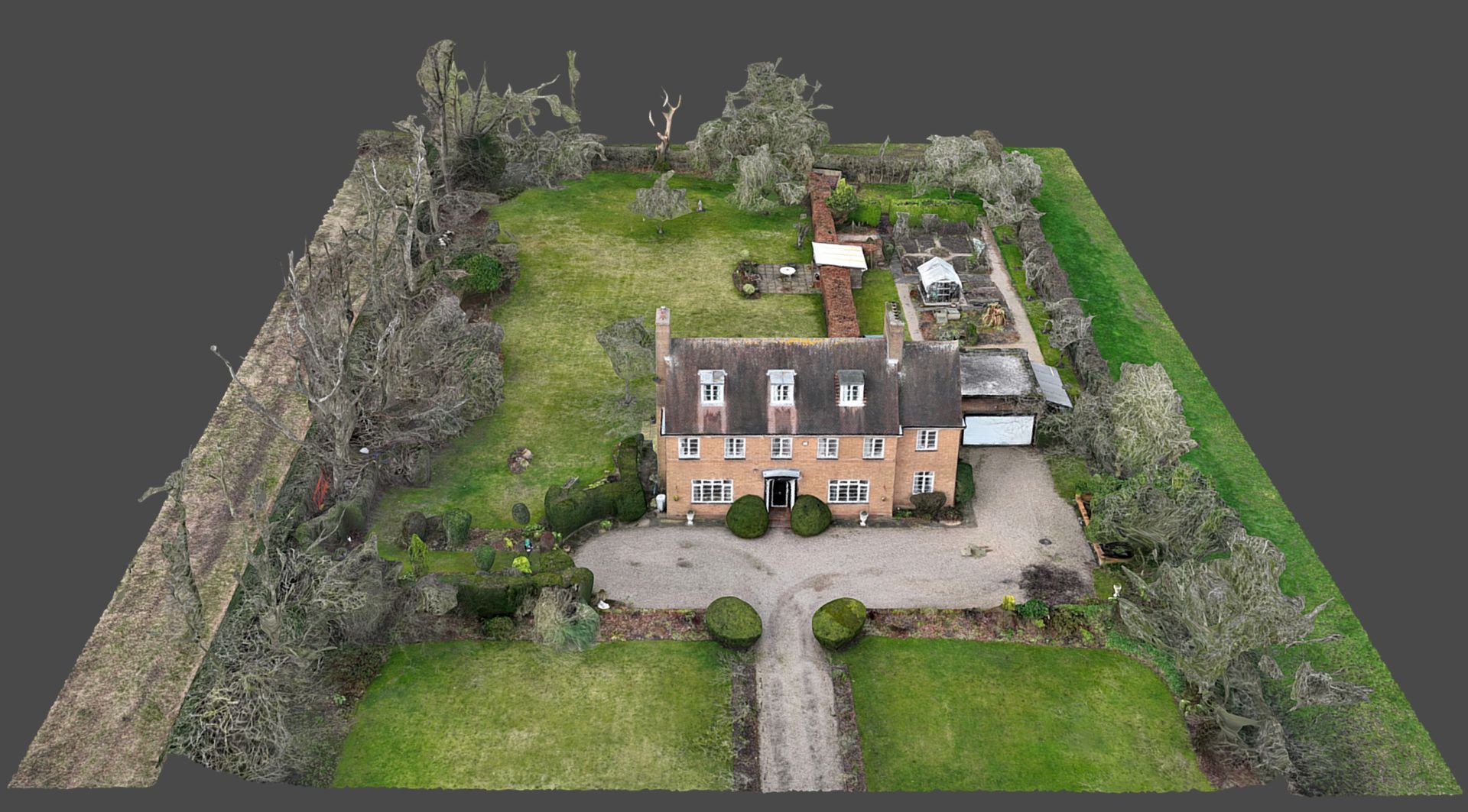
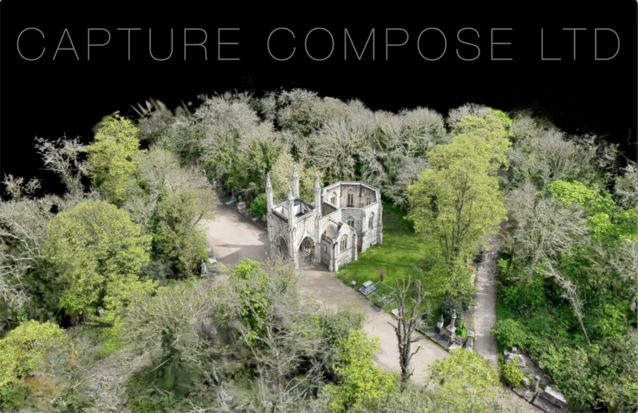
PHOTOGRAMMETRY: YOUR DIGITAL TWIN
Get hands on with our fully immersive 3D digital twin photogrammetry models. Save scrubbing through timelines or scrolling image libraries to reference your project material. Privately view & share 2D orthomosaics & 3D models online. File downloads available without subscription.
⥣ SELECT ICON TO VIEW MODELS ⥣
Our enterprise drone series are capable of sub-cm ground sampling distance with RTK positioning & rapid mechanical shutter. With coordinates pre-programmed ahead of shoot & stabilised images captured at up to 0.5 second intervals, precision grade missions are conducted with flights typical of 800 images in under seven minutes.
Popular export formats include OBJ, PLY, FBX, USDZ & GLB with online & local files available.
Operations from a Distance?
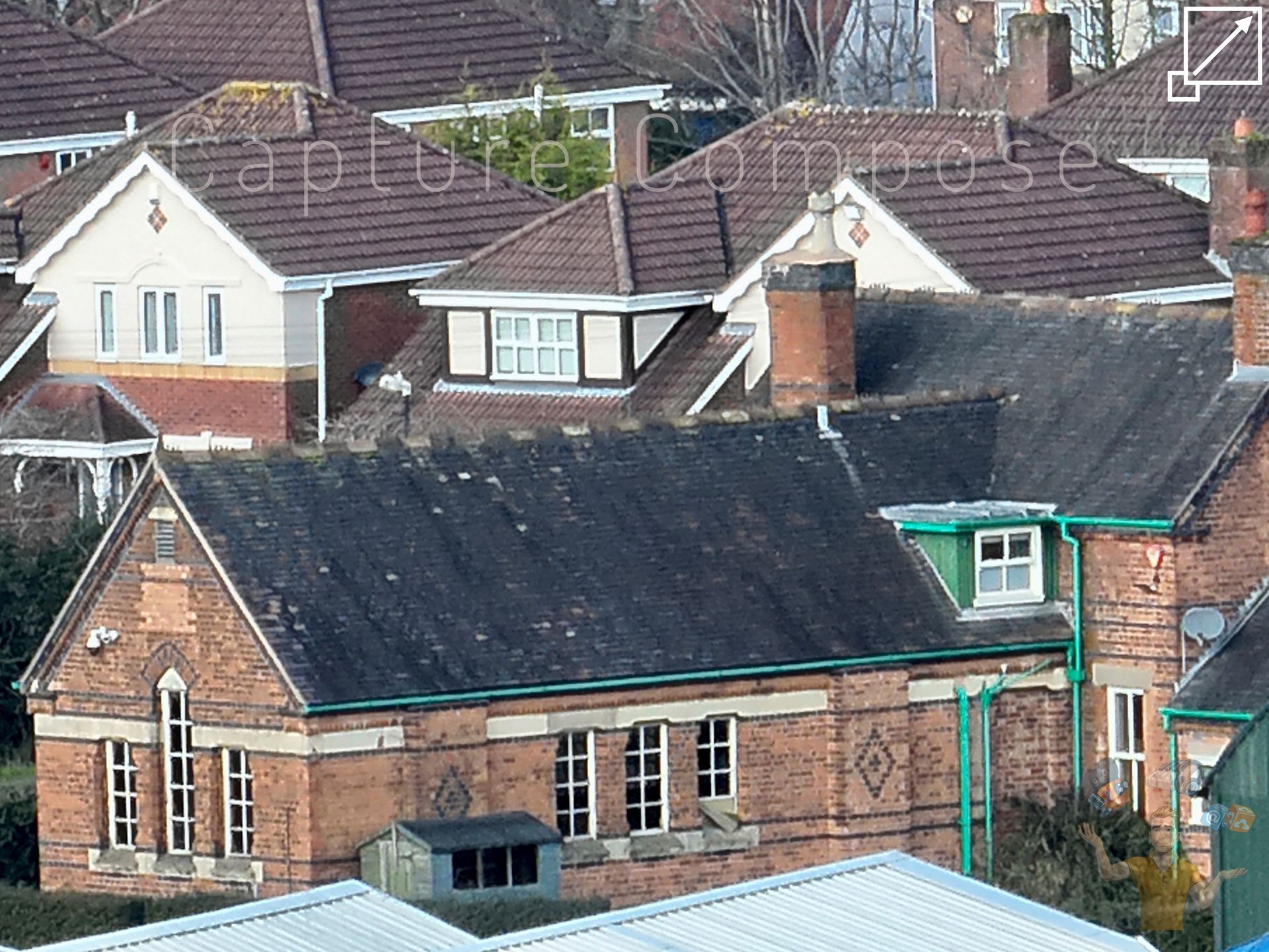
Capture 7x optical zoom with our enterprise drones plus < 112x hybrid zoom for a detailed & remote telescopic inspection. Ideal solution for sensitive conservation surveillance, flight zone boarders & safe operation around hazardous machinery.
-
THE COMPLETE SOLUTION
The Complete Solution
At Capture Compose Ltd we strive towards the complete solution offering inspection commodities for structural assets through ultra detailed three dimensional digital models. 4K resolution publicity film compliment interactive 360° panoramas & mixed reality virtual tours for location campaigns.
-
LET'S KEEP IT LOCAL
From consultation to post production, you can ensure a personal yet comprehensive experience with the founder of Capture Compose Ltd, Ade Franks. Encompassing all responsibilities under one roof including; drone operations, data processing, 3D modelling, cinematography, VFX & sound design.
-
A FEW YEARS UNDER OUR BELT
With over twenty years experience across the digital media & tech industry, we operate a skilled set of services to elevate your product, streamlining your content to the premium standards associated with inspection material & visual broadcast.
-
GLOBAL COVERAGE
Situated in London with vehicle access we are ready to travel UK wide. For international custom our flexible equipment offers the capacity for overseas portability, complete with public liability insurance & appropriate licenses.
PHOTOGRAMMETRY: YOUR DIGITAL TWIN
Get hands on with our fully immersive 3D digital twin photogrammetry.
Privately view & share digital models online. File downloads available
without subscription.
With coordinates pre-programmed ahead of shoot & stabilised images captured at 0.5 second intervals, precision grade missions are conducted with flights typical of 800 images in under seven minutes.
Popular export formats include OBJ, PLY, FBX, USDZ & GLB with online & local files available.
Operations from a Distance?
Capture 7x optical zoom with our enterprise drones plus < 112x hybrid zoom for a detailed & remote telescopic inspection.
Ideal solution for sensitive conservation surveillance, flight zone boarders & safe operation around hazardous machinery.
Farm remote aerial inspection:
Slide title
WIDE ANGLE AERIAL
Button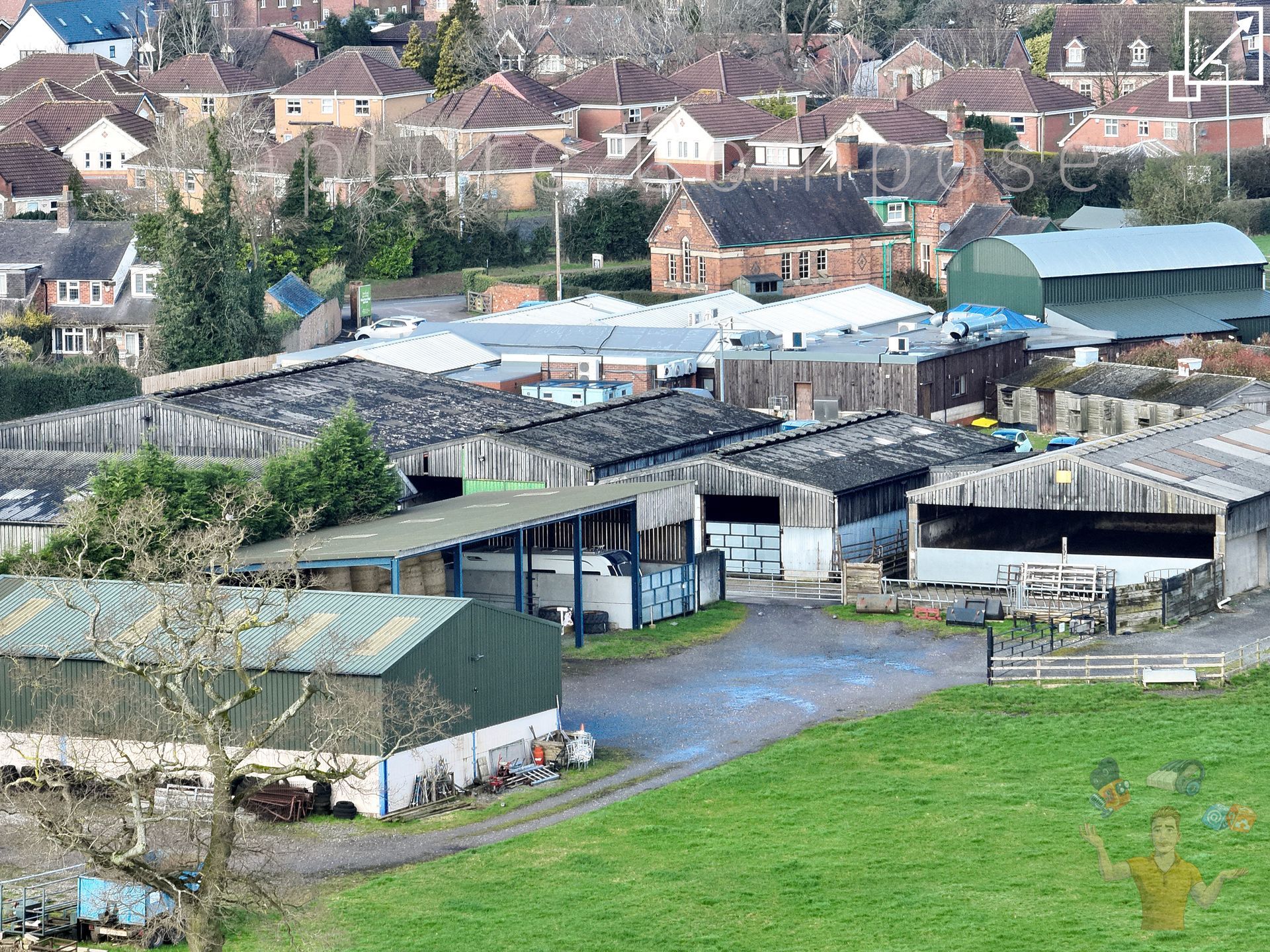
Slide title
7X OPTICAL TELE LENS
Button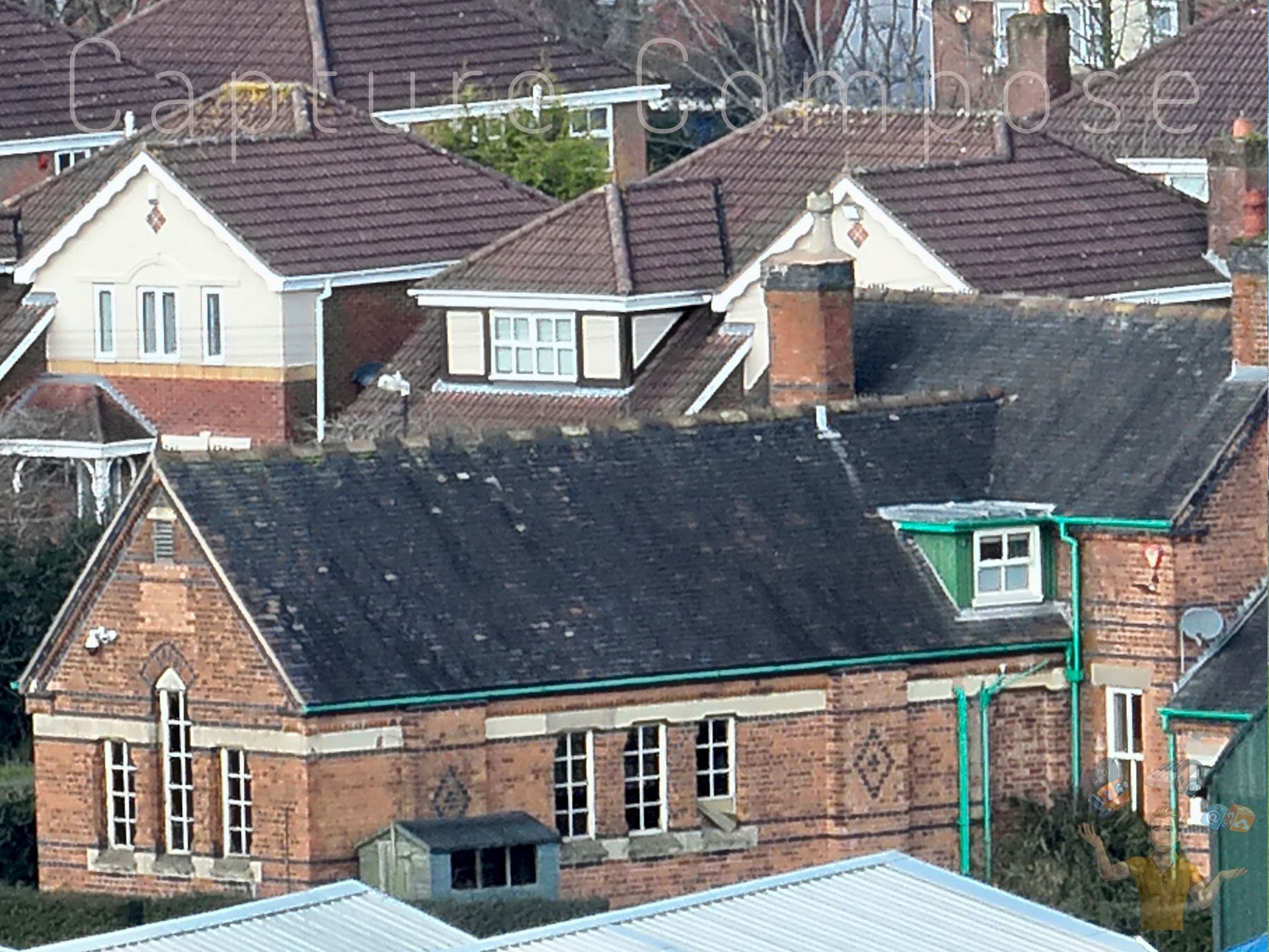
Slide title
56X HYBRID ZOOM AERIAL
Button
The Complete Solution
At Capture Compose Ltd we strive towards the quality shoot, priding ourselves on a tailored portfolio for exclusivity, high profile commodities & scenic cityscapes with the flex for structural inspection aerials & three dimensional property models.
Let's Keep It Local
From consultation to post production, you can ensure a personal yet comprehensive experience by the founder of Capture Compose Ltd, Ade Franks. All encompassing drone pilot, cinematographer, photogrammetrist & 3D editor, sound & VFX designer.
A Few Years Under Our Belt
With over twenty years experience across the digital media & tech industry, we operate a skilled set of services to elevate your product, streamlining your content to the premium standards associated with visual broadcast, reference & inspection material.
Global Coverage
Situated in London with vehicle access we are ready to travel UK wide. For international custom our flexible equipment has the capacity for overseas portability, complete with public liability insurance & appropriate licenses.
PHOTOGRAMMETRY: YOUR DIGITAL TWIN
Get hands on with our fully immersive 3D digital twin photogrammetry experience. Save scrubbing through video timelines or searching image libraries to reference your visual material. Privately view & share 2D/3D models online. Available also to store on device without subscription.
⥣ SELECT ICON ABOVE TO VIEW MODELS ⥣
Our enterprise drone series feature a 4/3 CMOS wide camera, ensuring accuracy with a 20MP sensor & rapid mechanical shutter. With coordinates pre-programmed ahead of shoot & high resolution images captured at 0.5 second intervals, millimetre level accurate missions can be conducted with flights typical of 800 images in under seven minutes.
Format exports include .usdz, .obj, .gltf with online & local files readily available.
Operations from a Distance?
Capture 7x optical zoom with our enterprise drones plus < 56x hybrid zoom for a detailed & remote telescopic inspection. An ideal solution for wildlife conservation surveillance, restricted flight zones & safe operation around high risk machinery.